
Find Records Along Tualatin Streets
A Tualatin street directory search starts with a location, not a person name. The county parcel identifier gives the address trail a stable key when an old street label, a postal city, or an annexation is confusing. On the Washington side, Intermap maps the site and exposes the Assessment & Taxation subreport. The owner-information route, recorded transfer, permit file, and any older directory inquiry follow after that first parcel match. Each result should be saved with its date and role.
Street-by-street research can document property relationships and the history of work at an address. It cannot turn a parcel screen into proof of every person who occupies a home. Keep the situs address separate from any tax mailing address, and keep a permit applicant, contractor, or deed party in the role the underlying record assigns.
- Normalize the street number and decide whether the parcel is in Washington or Clackamas County.
- Search the proper county map by address, account number, tax lot, or the available county equivalent.
- Save the situs address, account or tax-lot identifier, map context, and legal-description clue.
- Use the county’s stated office channel for tax-purpose ownership assistance if the public map does not supply it.
- Request the recorded transfer and preserve the grantor, grantee, date, and book or document reference.
- Check a City permit or land-use file to date a project at the address.
- Ask the library about a historical directory only after it confirms a specific volume and year.
Tualatin Streets Need a County Check
Tualatin is not wholly inside one records system. The City’s public report places the Washington and Clackamas County line at SW 65th Avenue beside Meridian Park Hospital. Washington County lies west of the divide and Clackamas County lies east. An address-search result for one side should not be treated as a result for an address across that line, even when both carry a Tualatin mailing label.
For a Washington-side address, use Intermap and the county’s mapping and recording channels. For the Clackamas side, begin with the County GIS and property resources. Clackamas CMap supports address, parcel-number, tax-lot, or intersection research but withholds owner names online; AscendWeb supplies separate account and address modes. The different input choices are a reason to identify the county before trying to build a Tualatin street trail.
Washington County’s GIS resources and Clackamas County GIS are the official map starting points. A ZIP or nearby city name is not a substitute for the mapped parcel and county.
Note: A Tualatin street address should carry its county and tax-lot context before any recording or ownership follow-up.
Tualatin Street Directory in Intermap
Washington County documents three Intermap search keys: Situs Address, Account Number, and Tax Lot ID. After selecting a map location, scroll to Additional Information and open Assessment & Taxation Information. The County says the linked subreport can provide general property information, sales and deed information, assessed values, and improvement information. That makes Intermap the lead tool for a Washington-side Tualatin street directory, but it does not promise an anonymous owner-name search.
Its map-first design is useful because it separates the physical parcel from the name question. First save the county identifiers and map clues. Then use Cartography’s lobby computers, phone, or e-mail for the county’s tax-purpose ownership assistance. The county also warns that mapped boundaries serve tax and assessor purposes. A parcel outline is not a field survey, and an owner field is not a household list.
| County field or action | When used | Street-directory result |
|---|---|---|
| Situs Address | When the property location is known | Finds the map location and parcel lead |
| Account Number | When a county account is known | Reconnects the record to the tax parcel |
| Tax Lot ID | When map or deed material supplies a lot key | Bridges plats, maps, and assessment information |
| Assessment & Taxation Information | After the map result is selected | Provides the county-described property, sale, value, and improvement details |
Tualatin Street Property Access Compared
Washington County has two complementary public routes. Intermap is the county-described mapping and subreport tool. Property Public Access is a free guest portal with Address, Tax Lot ID, and Property Identifier search inputs. It starts suggestions after at least three characters and can return an address and Property ID. Its expanded results can include a situs address, legal description, neighborhood code, subdivision, property type, value, improvements, sales history, tax bills, and related properties.
Both systems are strong address-to-property tools, but they do not make a public street directory complete. Property Public Access suppresses protected owner names and addresses, and the County’s standard owner-information path may still require the counter, phone, or e-mail. Treat a tax mailing address as correspondence information. Treat any owner name as a dated property relationship rather than a statement about all residents at the street address.
The Washington County Property Public Access portal shows the guest search entry point.
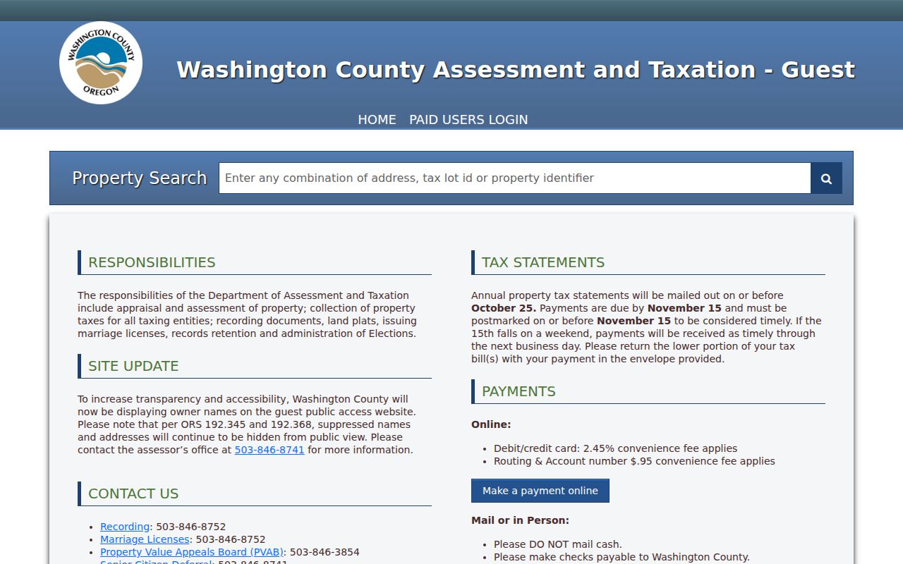
The search screen illustrates why an address, tax lot, or property identifier is a better starting point than an unsupported name-only street search.
The public government-owned detail example shows the portal’s parcel-record layout without using a private residential sample.
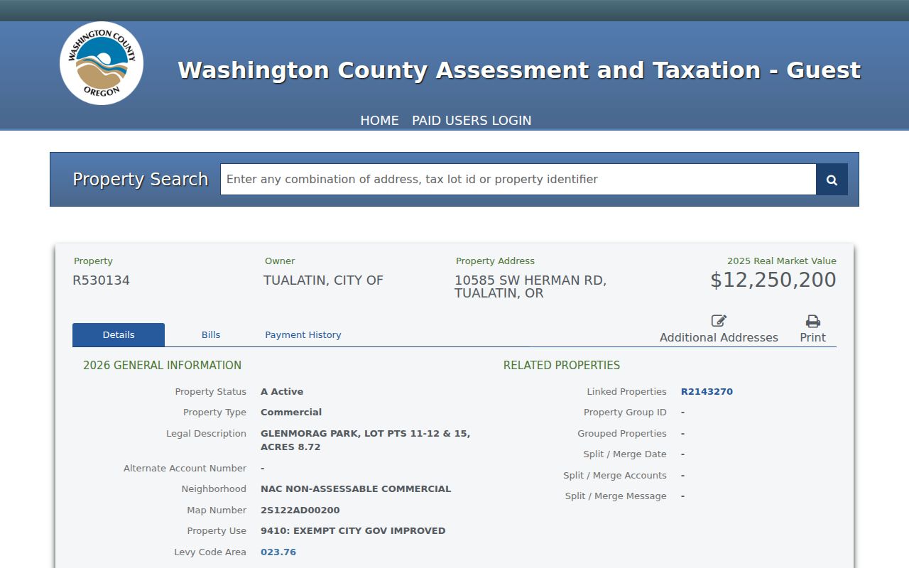
Use the displayed legal description, map number, account, and sales-history clues to frame the next custodian request, then verify records with the office that maintains them.
Tualatin Records Searchable by Street
Several address-keyed record sets can support a Tualatin street directory search, yet each has a narrow purpose. Intermap and Property Public Access connect an address to a parcel and tax data. Cartography provides tax-purpose ownership assistance through its stated channels. Recording documents transactions. Survey Explorer adds plats, surveys, county roads, and land-claim context. City files can date a project. The evidence chain is strongest when the same legal description or tax lot appears in more than one record.
| Address record set | Custodian | What it can establish | Access boundary |
|---|---|---|---|
| Intermap assessment subreport | Washington County Assessment & Taxation | Situs, account or tax-lot key, property, sale, value, and improvement information | Address, account, or tax-lot route; no promised public owner-name search |
| Cartography assistance | Washington County Cartography | Tax-purpose ownership help and assessor-map context | Lobby computers, phone, or e-mail |
| Survey Explorer | Washington County GIS | Survey, plat, tax-map, road, public-land-corner, and Donation Land Claim context | Map and dataset tool, not a household record |
| Recorded documents | Washington County Recording | Grantor, grantee, date, legal description, and volume or page | Current copies by office visit or e-mail; historic index and microfilm channels |
| Permit and land-use files | City of Tualatin | Project, inspection, plan, or recorded party role | eTRAKiT or a precise City request |
A parcel, tax lot, or legal description is the useful handoff between these sources. A street name alone can recur, shift in use, or cross a boundary. For the broader current-record landscape, use the home search options after the address trail has been identified.
Tualatin Street Deeds and Plats
A recorded deed creates the backward portion of a street directory trail. After locating the parcel, request the current recorded transfer from Washington County Recording. Preserve the grantor, grantee, recording or filing date, legal description, consideration if recorded, and volume or page reference. The current grantee may appear as a grantee on an earlier acquisition. Compare the legal description, lot, block, or plat at each step rather than trusting the same street number over time.
The County’s live Recording page does not state a public online historical-index cutoff. The State Archives inventory supplies the fallback: Washington County deed and index material spans 1847 to 1977, direct and indirect index microfilm spans 1850 to 1977, and specific deed-book microfilm routes reach from 1850 into the 1960s. The State Archives also identifies a Direct Index to Deeds for 1850 to 1882. Those are counter, archive, and microfilm routes, not a promise of a free online title chain.
The Washington County Recording page is the current office and copy-request channel for deeds and related documents.
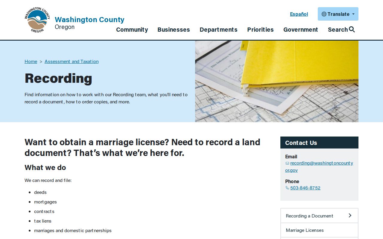
Recording can supply a document copy after the property trail identifies what to request. A recorded transfer establishes a transaction and parcel relationship, not a complete history of people at the address.
- Grantor
- The party that conveyed an interest in a recorded document.
- Grantee
- The party that received the recorded interest.
- Plat
- A recorded map showing the layout of lots, blocks, or related land features.
- Legal description
- The land description used to connect recorded documents even when a street label changes.
Tualatin Permit History by Address
City eTRAKiT adds a local project layer to the Tualatin street directory. The City describes it as a 24/7 tool for permits, land-use applications, plans, inspections, project status, fees, and historical permit research. A valid use is to search the address or project route available in the live interface, retain a permit number, and ask the City for a missing older record by address, approximate date, department, and record series.
The observed eTRAKiT property page has Search By, Search Operator, and Search Value controls. Result areas include parcel information, owner information, restriction details, land use, building, legal description, and inspections. The permit route was login-gated during research even though older City material describes guest searching. That conflict means the current anonymous permit-search fields and coverage need live confirmation before relying on them.
The Tualatin eTRAKiT permit-search route is the assigned City portal source for address-based permit research.
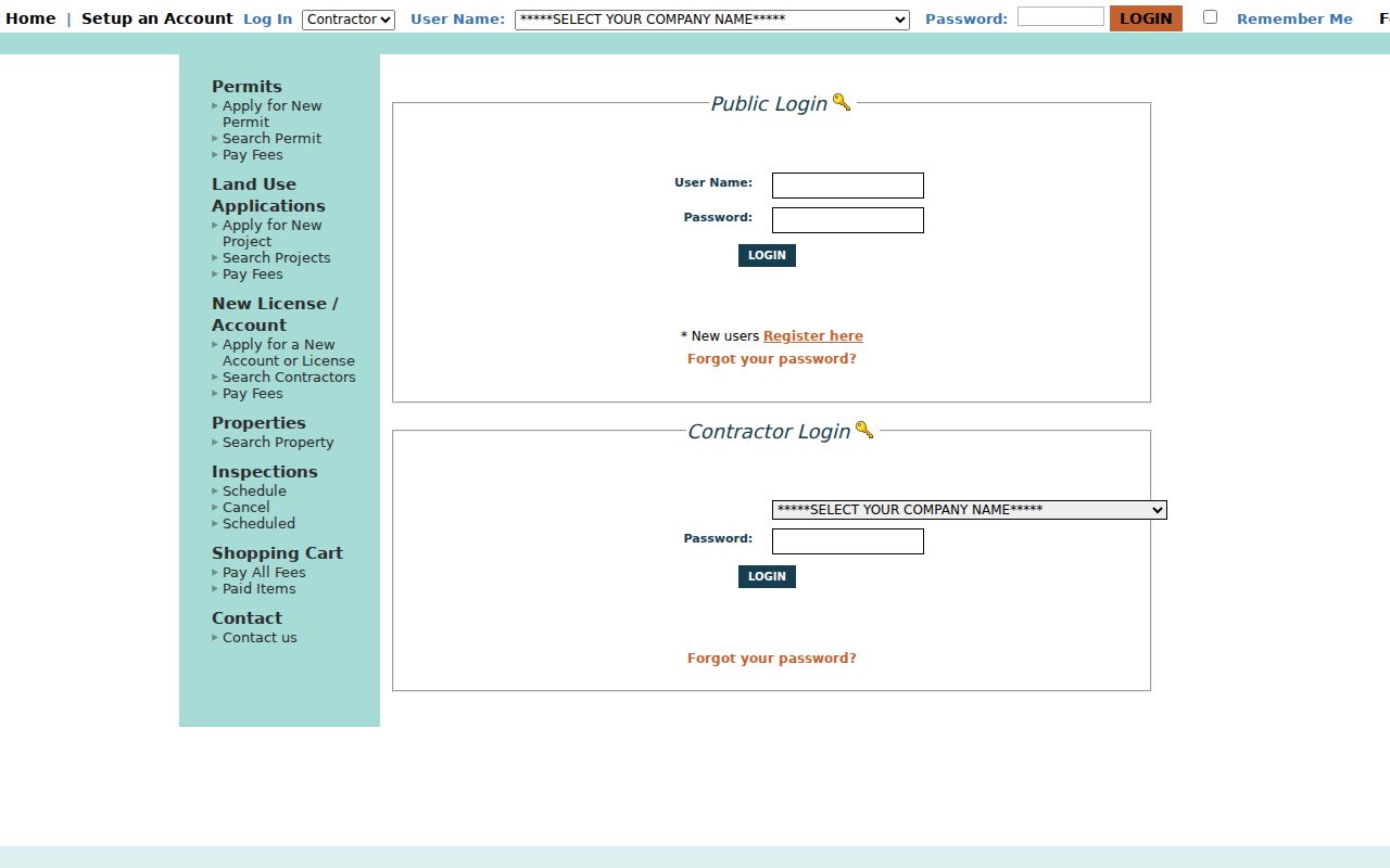
Use a permit number to request the underlying City record when access allows. An applicant, contractor, or owner identified in a project file is not automatically a person living at that address.
Tualatin Street Clues Before Web
Historic Tualatin street research has a local naming quirk. City history records Galbreath ferry service, the Bridgeport name after the bridge, the railroad-era Tualatin town plat, and incorporation in 1913. Historical Society material also gives the early spelling Tualitin. An old map, news item, or archive entry can use one of those older names rather than a current city or street description. Tie it to a legal description, lot, plat, or county record before treating it as the same property.
The research did not verify a specific Tualatin reverse or criss-cross directory run, a citywide street renumbering, or a local digitized directory shelf. The fallback is Tualatin Library Reference, then Washington County historical materials and Tualatin Historical Society. Ask for the exact address, year, publisher, volume, and abbreviation key before using a historical directory entry. The Tualatin city directory resources explain that collection check in more detail.
Annexation records also make legal descriptions safer than a modern mailing label. City ordinance and project records can preserve a street description with a tax-map or lot reference, which helps reconcile a later city boundary with the historic parcel trail.
Note: No source found a documented citywide Tualatin street renumbering, so an old mismatch needs source-by-source reconciliation rather than a guessed conversion.
Tualatin Street Search Beyond Maps
When a map screen stops, follow the record to its custodian. Washington County Cartography directs ownership questions to Suite 130 customer-service computers, phone 503-846-8741, or e-mail. Recording accepts document-copy requests by office visit or e-mail, with payment before mailed copies. For City files, use the address, project number if known, record series, department, and date range in a request to the Deputy City Recorder. That specificity gives each office a record it can locate.
Historic street work also has offline channels. The State Archives inventory identifies deed books and direct or indirect index microfilm for Washington County, while the Tualatin library and Historical Society can check whether a local directory, photograph, oral history, or map applies to a particular address and year. The City records-request form permits review at City offices, e-mail, mail, or pick-up for a nonexempt City record. None of these channels creates a resident list, but each can close a documented address-record gap.
Street Directory Limits in Tualatin
A Tualatin street directory does not identify every household member, guest, utility customer, mail recipient, or person registered at an address. A property owner may not live at the parcel. A tax mailing address may point elsewhere. My Vote is self-service, not public street browsing, and voter-address protections can remove qualifying records from accessible data. DMV information and private utility records are not a general street-level resident source.
Use an official parcel, recording, permit, court, election, archive, or City request channel for the particular fact being checked. Keep each source’s date and party role. When an access route returns no available record, it means that source did not yield an accessible record, not that the person or household does not exist.